
3D modeling services offer an efficient and cost-effective way to make use of high-density, high-accuracy 3D models. Technically called orthomosaic maps, they are created with a large number of overlapping photos covering a defined area. After capturing precise aerial imagery, we then use powerful mapping software to stitch the photos into geo-rectified orthomosaics.
Our drone surveys capture specific areas of interest with images or laser cameras, and we then process the data to produce our unique 3D modeling solutions.
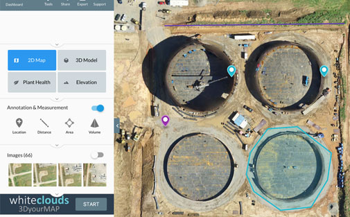
We can produce sophisticated 2D maps and 3D digital elevation models that enable you to fill in imaging gaps left by satellite mapping with up-to-date data.
We will provide you with an advanced 3D model of your assets. You can fully interact with the model and use it to perform calculations, including measuring distance, area, and volume. These tools are ideal for getting measurements, calculating areas of fields, and understanding where equipment is located.